Geofences
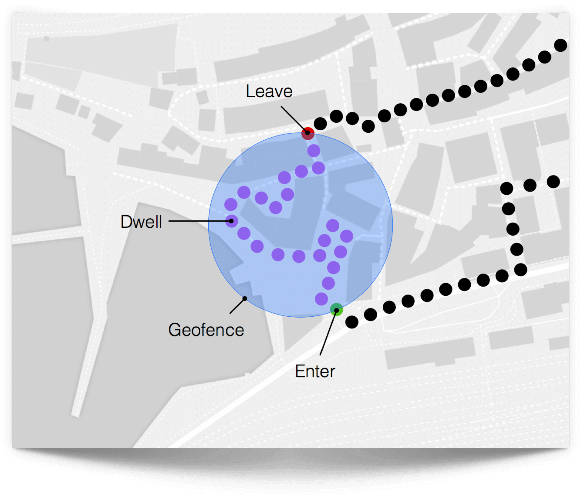
Geofences are virtual geographic boundaries that enable you to trigger actions when a device enters, leaves or stays in a particular area.
Read more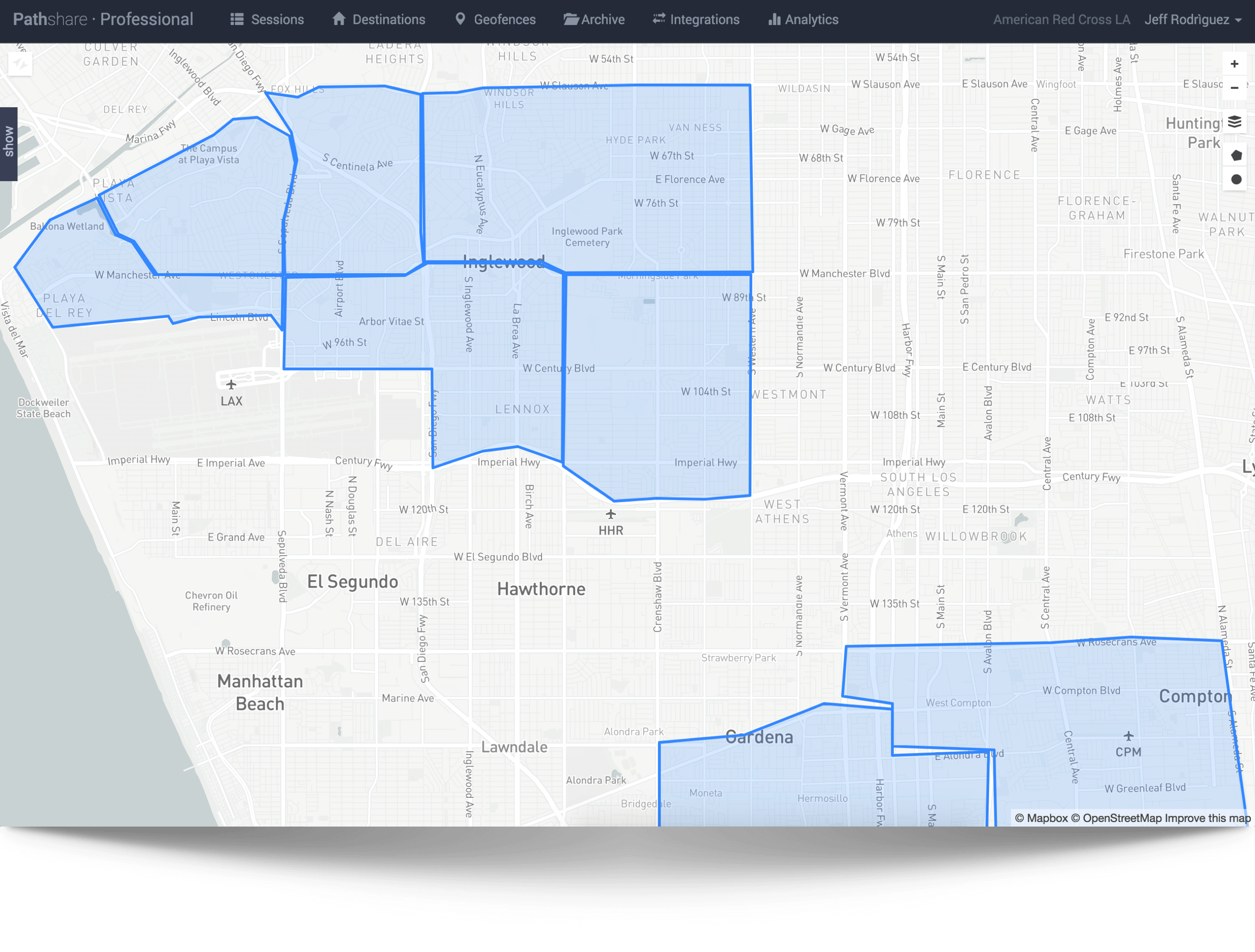

Geofences are virtual geographic boundaries that enable you to trigger actions when a device enters, leaves or stays in a particular area.
Read more

Geofences are a great way to trigger actions and give users a contextual experience around their area of interest.
Here are a few examples:
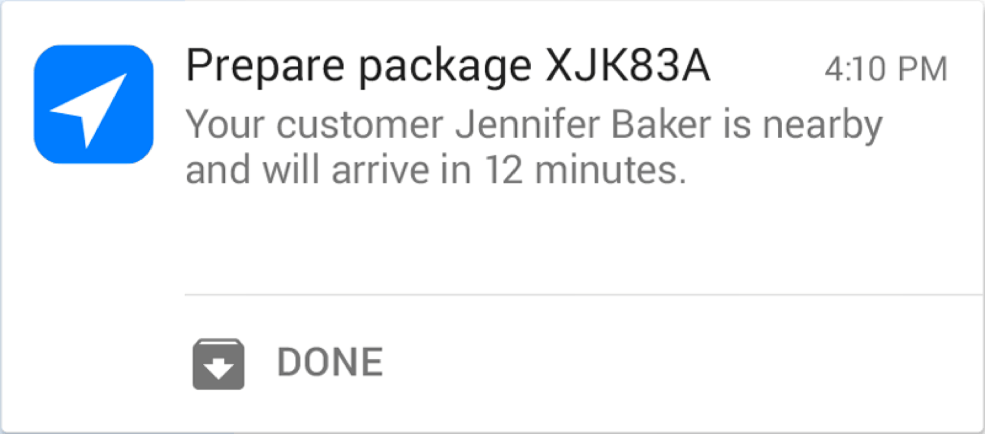
Send location based push-messages to a customer approaching a geofence.
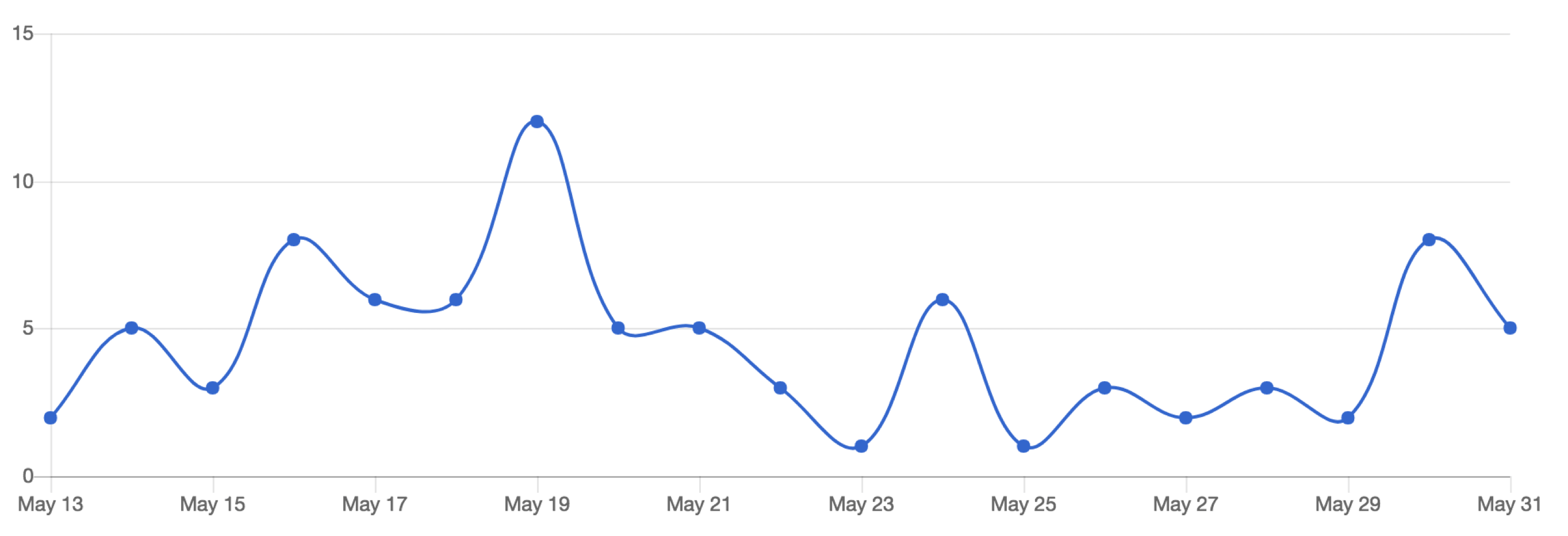
Save location visits to build up highly accurate customer profiles.
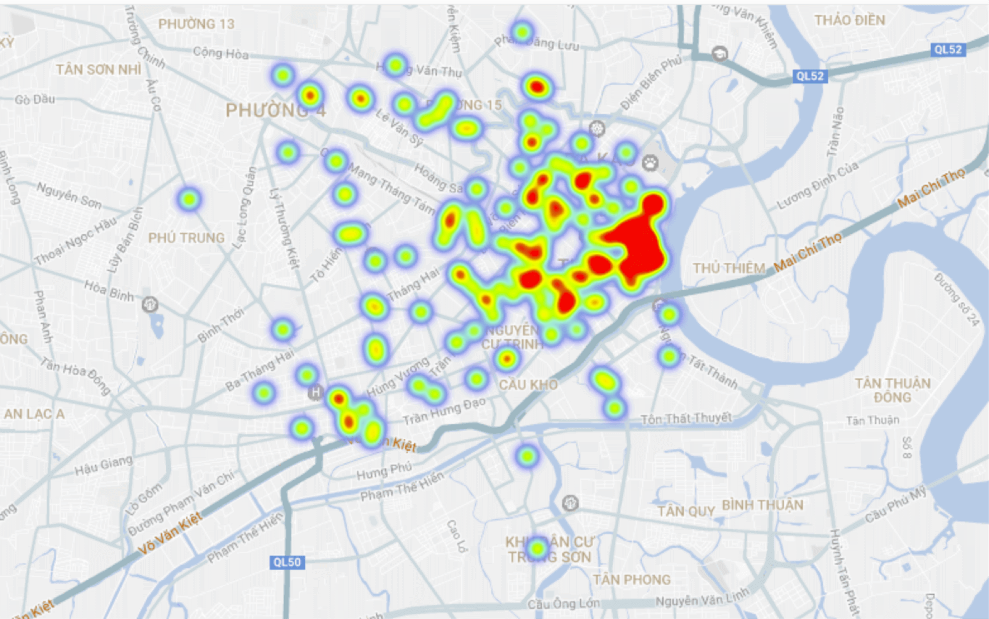
Analyze how customers move towards a venue and how many pass without entering.
Trigger an external application like charging a guest for the number of times he used the ski lifts.
Hint: When using a geofence to trigger things, this simply call this a geotrigger.
Creating geofences is very simple and the Pathshare Dashboard offers you all the visual tools needed. Learn more about best practices in the geofences documentation.
Pathshare provides you with a map based visual tool to set up and manage your geofences and define actions like sending a message to your customer or executing a web service.

Draw circles (radial geofences) and polygons directly on the map to define new geofences. You can also use Geofence API to upload and bulk-import your predefined set of geofences directly to your Pathshare Pro account.
If you would like to set fences around routes or just need help uploading your geofences, please contact us and send us your geofence files - we’re happy to do it for you.
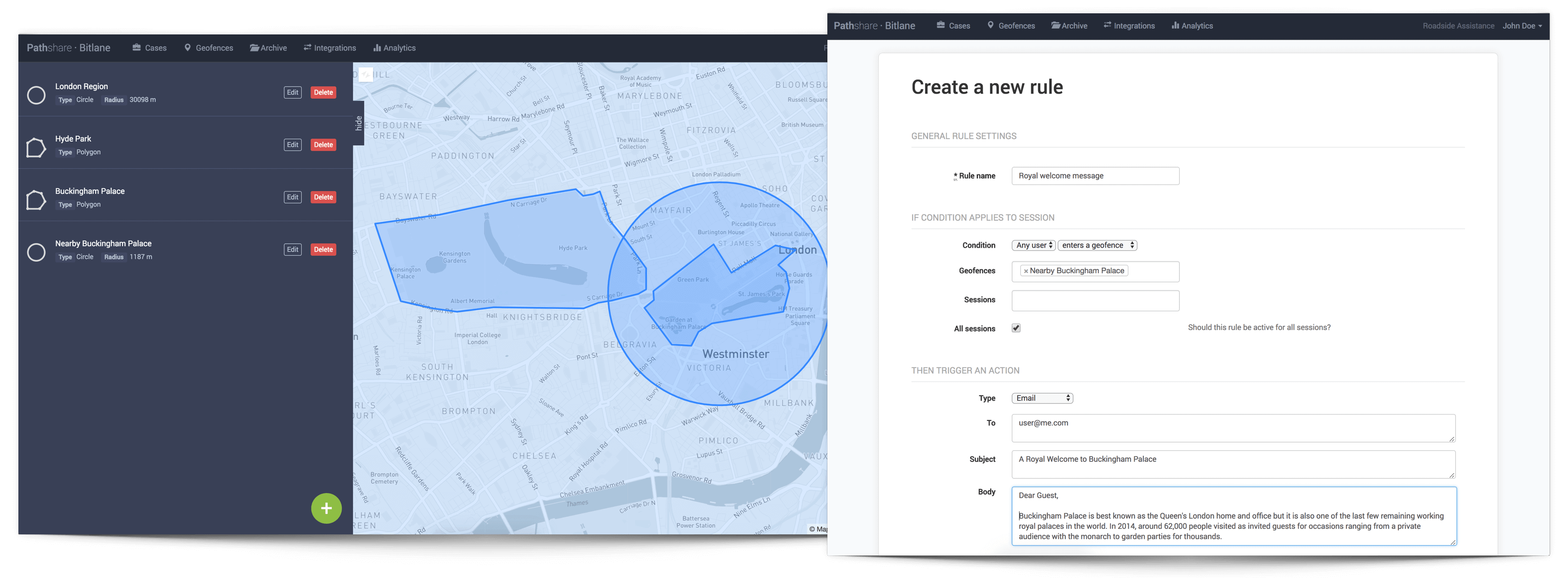
As soon as your geofences are set up, every device that enters or leaves a geofence will trigger an event to Pathshare. You can now define if-this-than-that rules how to use geotrigger events, e.g. in order to send a welcome message to your user if he enters the perimeter of an area of interest.
Geotriggers support all integration types from Pathshare integrations to send emails or evoke any other REST service using the config or with Zapier (a workflow automation tool).
Sign up for a free trial account,
or talk to a member of our sales team.